We did this walk on the 15th of December, using these track notes (which everyone seems to have used and I think they’re the only ones available) and the topo map I marked up with locations of the passes using this handy map. We arrived at the carpark around 9:30. Party of Izzy, Lucy, Luke and myself.
Finding the tracks to Black’s Ladder was tricky – we seemed to go too far on the section “700m till you get to the big bend at K472673.” and had to bushbash NE rather a lot until we found the power pole, which now has lines attached to it leading downhill making it easier to spot. One of them is lying on the ground downhill, we stepped over it rather carefully but inadvertently walked into it later on with no harm done! We then found the old track just next to it and followed the many cairns past a distinctive grove of twisted scribbly gums.
Very much a route that will be easier to find next time. Alternatively, some walkers have taken the old route through the more northern firetrail and found this not too overgrown. It may be that Alan Well’s recommendations are out of date. Either way, be prepared to find your own path and a map is essential.
Another misstep followed halfway down the low cliffline when we turned left too early (“down through a low cliff and on to a footpad which shortly leads down and around to your left, under the low cliff and just above the creek on your right”). We found an old fireplace in a potential camp cave, traffic to which has presumably created the footpad we followed. Of course we also bashed beyond it for quite some time, not helped by my having marked the pass on the wrong arm of the creek – it is on the eastern arm – and thus trying to reach the western arm of the creek.
After backtracking, it was 12:00 when we descended the spikes and had some sandwiches by the lovely waterfall. I refilled some water in the pool (with purification tablets just in case). This is the last reliable place to get water – I used another waterfall later on but it was very slow to fill and I imagine it would dry up to be unusable as summer continues. We each drank at least 2 litres on a fairly hot day.
Following the base of the cliffs took about 3.5 hours, with various stops. It’s only about 2.5km but there is a lot of scrub and backtracking. I was bothered by some bull ant bites, which as I did not see the ants, could have been a spider or a snake or a venomous beetle or….. Thankfully it is Tuesday and I am still alive!
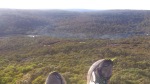
Climbing down to a lower height (spot the 3 walkers). This way does not work.
We stopped for some water at the very end of Megalong Head and spotted a way we could potentially climb up the detached cliff. Izzy and I scouted it while Luke and Lucy dealt with a leech down below, then engaged in a lot of yelling “THIS WAY WORKS” “DID YOU SAY WE SHOULD COME” “YES AFFIRMATIVE”. We climbed straight over the semi-detached section and into the gap. It seemed shorter and more straightforward than going around to the south side as recommended, but there is no marker to tell you where to climb so it was just a bit of luck.
We didn’t have any problems following the instructions for the pass, with Izzy tearing straight up like there was no drop at all. (She was also the only one not carrying a pack at this point :p) We have been intending to see how we will deal with exposure prior to potentially doing the Mt Anne circuit later this year, and certainly no-one in the party seems to panic and become uncertain – or take too many risks. Moreover the party, which was a bit hot and bothered earlier in the day, was filled with a wonderful sensation of victory as we all reached the top and admired the views.
At the top many cairns led up a steep hill until the trail becomes very distinct. The walk back to the cars takes half an hour from here. By 4:30 we were all ready to go.
All in all it was an enjoyable day. For sheer pleasure and variety, there are other walks in the Blue Mountains I would do first. For our training purposes it was great, with challenges to our navigation, fitness and climbing skills.